We've spent most of the class looking at vector data so why are we now going to switch to rasters? Vector data only covers a small portion of the earth's surface. Points are just that, infinitesimal small points on the earth. Polylines show us where the roads and streams are but really just give us the center of the streams and roads. Polygons show us areas but have the same value for all the area within the polygon. What we need is a data type that allows us to perform analysis on data that changes as it moves across the land scale and covers large areas. This is where rasters come in.
You've already worked with rasters in digitizing data from satellite photos. Photos are just one type of raster, others include:
Notice that for each of these you could measure a value at one location, move some distance and then measure another value. The values change continuously across the earth. You could also represent these types of data with polygons but you'd have to make a single polygon for one value and then another polygon for another value. It's not that any one data type is better than another but one data type will be the best one for the type of analysis you are attempting.
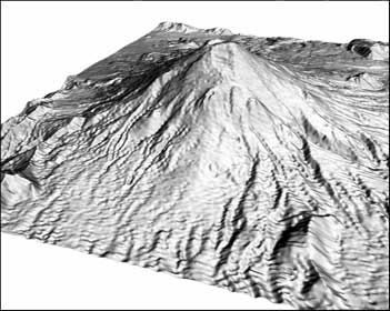
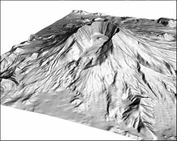
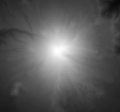
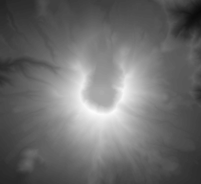
As an example, below is an "image" of Mount Saint Helens before the volcano erupted and another one after. These 3D images were created from a Digital Elevation Model or DEM. The DEM is shown below the 3D image. The DEMs are not as interesting to look at but they are very interesting for analysis. From these images you can compute the amount of mass that was lost during the eruption. This is the type of work that is enabled by rasters.
| Before | After |
|---|---|
|
|
|
|
Raster analysis, like vector analysis, is a huge field and we'll only cover a few of the topics in this class. Raster analysis topics we discuss will include:
Rasters can be very large in size (i.e. the number of "bytes" they require on disk and in memory). To have rasters work well with ArcGIS, I recommend:
© Copyright 2018 HSU - All rights reserved.